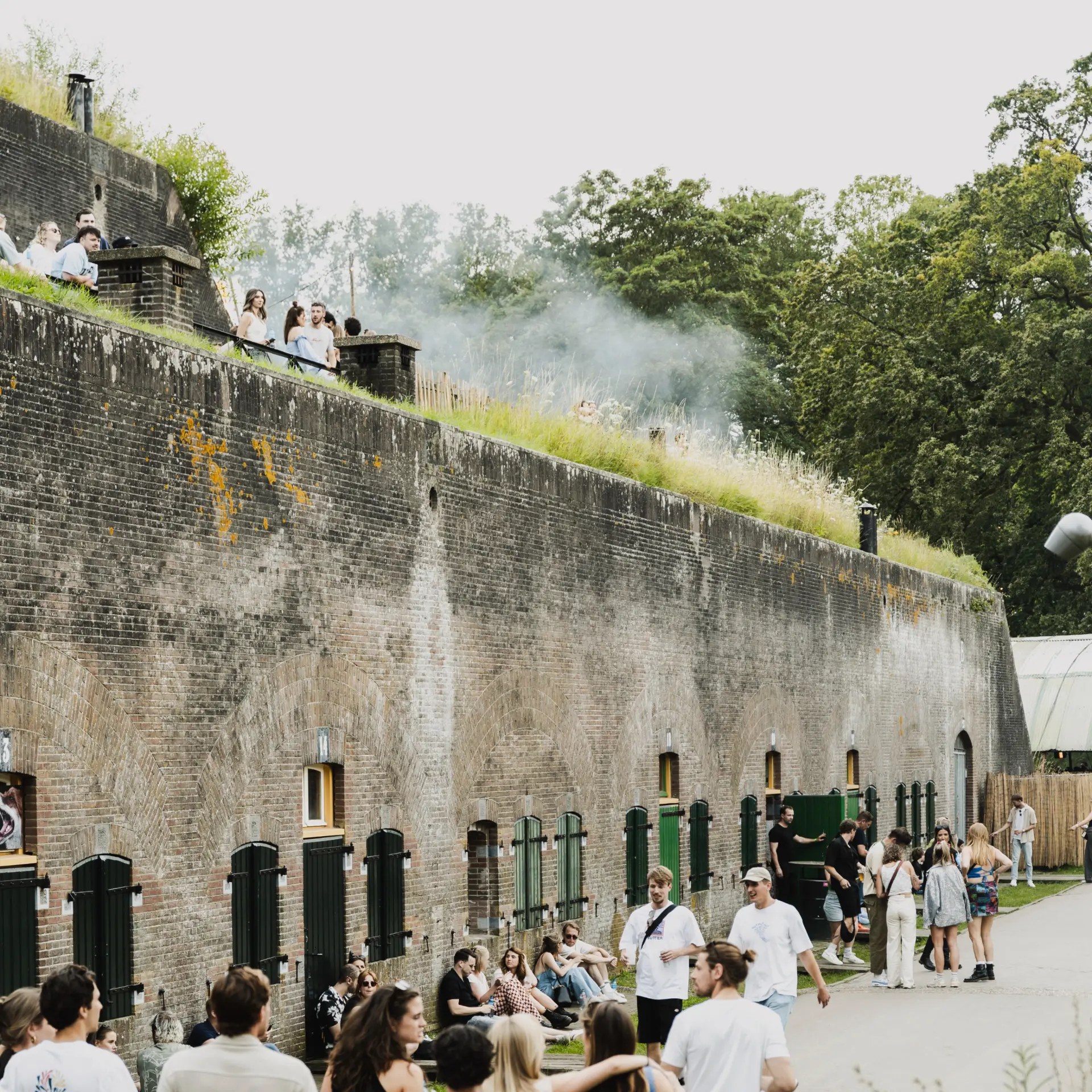
You find yourself in a dark room, hidden beneath metres of concrete. Finding your way is difficult. Your hand searches for guidance along a damp wall. Then you hear a low rumble. The sound travels through the ceiling and walls, softened by the thick layers of earth and stone above. It echoes steadily through the space. On 25 July, it’s the bass from Orbit Festival that fills the casemates. But centuries ago, the very same sound could have announced approaching Batavian rebels, marching French troops or German aircraft overhead. For nearly two thousand years, this place has played a role in defence.
UNESCO World Heritage Sites
Fort bij Vechten is a unique location. It forms part of not one, but two UNESCO World Heritage Sites. UNESCO World Heritage recognises places of outstanding cultural or natural value to humanity. More than 1,200 sites around the world carry this status, from the Great Wall of China and Machu Picchu to the Pyramids of Giza. The Netherlands is home to thirteen of them. Since 2021, Fort bij Vechten has been one of the few places where two of these World Heritage Sites come together: the Dutch Water Defence Lines and the Lower German Limes. Both show how people have shaped the landscape in search of safety across different periods in history. Fort bij Vechten is one of the rare places where these two defensive systems meet.
The Roman Frontier
At the beginning of the first century AD, this location played an important role in defending the Roman Empire. This was where the empire’s northern frontier ran: the Lower German Limes. The Latin word limes simply means “border.” The frontier formed part of a defensive system stretching around 6,000 kilometres, from northern Britain to North Africa. Along this border, the Romans built forts, watchtowers and roads to safeguard their vast empire.
In the Netherlands, the Limes followed the course of the Rhine. At strategic locations, the Romans established military camps, one of the oldest and most important being Fectio, located at what is now Fort bij Vechten. Around AD 4 or 5, a castellum was built near the point where the Rhine and the Vecht rivers met. This strategic position allowed soldiers to move quickly while supplies could easily be transported by water. Fectio grew into one of the largest Roman forts in the Low Countries and housed an exceptionally strong military garrison.
As with many Roman forts, a lively settlement soon developed around Fectio. Traders, craftsmen and the families of soldiers settled nearby. The frontier became more than a military border; it was also a place where people, goods and ideas came together. Its location also brought challenges. Frequent flooding forced the Romans to rebuild and strengthen Fectio several times. Centuries later, those same rivers and waterways would become the foundation of a new defensive system: the Dutch Water Defence Lines.
The Water Defence Lines
From the sixteenth century onwards, the Dutch discovered that water could become an effective weapon. By deliberately flooding polders, they created a shallow layer of water that was too deep to cross on foot and too shallow for boats to pass. Enemy armies became trapped in the landscape. This led to the development of the Dutch Water Defence Lines: an ingenious network of forts, locks, dikes and inundation fields unlike anywhere else in the world. The first waterlines were built in the eastern Netherlands during the sixteenth century. In the early nineteenth century, the New Dutch Waterline followed, protecting the western part of the country.
For a long time, the Dutch Water Defence Lines remained a military secret. They appeared on no maps. Only the forts were visible, guarding vulnerable passages that could not be flooded, such as roads, railways and waterways. Between 1867 and 1870, Fort bij Vechten was built on the very site where the Roman castellum had stood nearly two thousand years earlier. Like Fectio before it, the fort grew into one of the largest defensive structures of its time, becoming the second-largest fort of the New Dutch Waterline.
Vechten?
Although Fort bij Vechten was built to defend against an enemy, it never took part in an actual battle. It was mobilised several times, including during the Franco-Prussian War (1870–1871) and the First World War. During these periods of international tension, tens of thousands of soldiers occupied the Water Defence Lines, remaining on constant alert while daily life continued inside the forts.
When the Second World War began, the centuries-old defensive strategy had largely lost its effectiveness. The Dutch Water Defence Lines had been designed to stop armies advancing across land, but the rise of air power changed everything. German aircraft simply flew over the flooded landscape. As warfare evolved, the forts gradually lost their military purpose. After the war, many were given new roles.
Immediately after the Second World War, dozens of forts were used to imprison members of the Dutch Nazi movement (NSB), Dutch SS volunteers and other collaborators. Later, they held conscientious objectors who refused military service during the Indonesian War of Independence. It is estimated that between four and six thousand Dutch soldiers refused deployment to Indonesia, receiving prison sentences as a result. During the Cold War, many forts also became part of the Dutch Civil Defence organisation, which prepared the country for the possibility of a new world war involving nuclear weapons.
From Roman castellum to fort of the Dutch Water Defence Lines, Fort bij Vechten has occupied a strategic place in the landscape for almost two thousand years. Once built to keep enemies out, today it welcomes people to gather around music, history and the landscape that connects them.